Balancing Housing Growth with Biodiversity

Opportunities across Green Belt, Grey Belt and brownfield land
The UK Government has set ambitious targets to deliver 1.5 million new homes over the next five years. For developers, understanding which types of land have potential to be brought forward for housing, and the ecological constraints and opportunities associated with them, is critical to successful and timely project delivery.
Terms such as Green Belt, brownfield and Grey Belt are frequently referenced in planning policies and land-use strategies. In practice, each presents a distinct set of ecological risks, planning challenges and opportunities that can directly affect the kind of development that will be allowed, the size, associated costs and the likelihood of planning permission being granted.
Green Belt: protected countryside
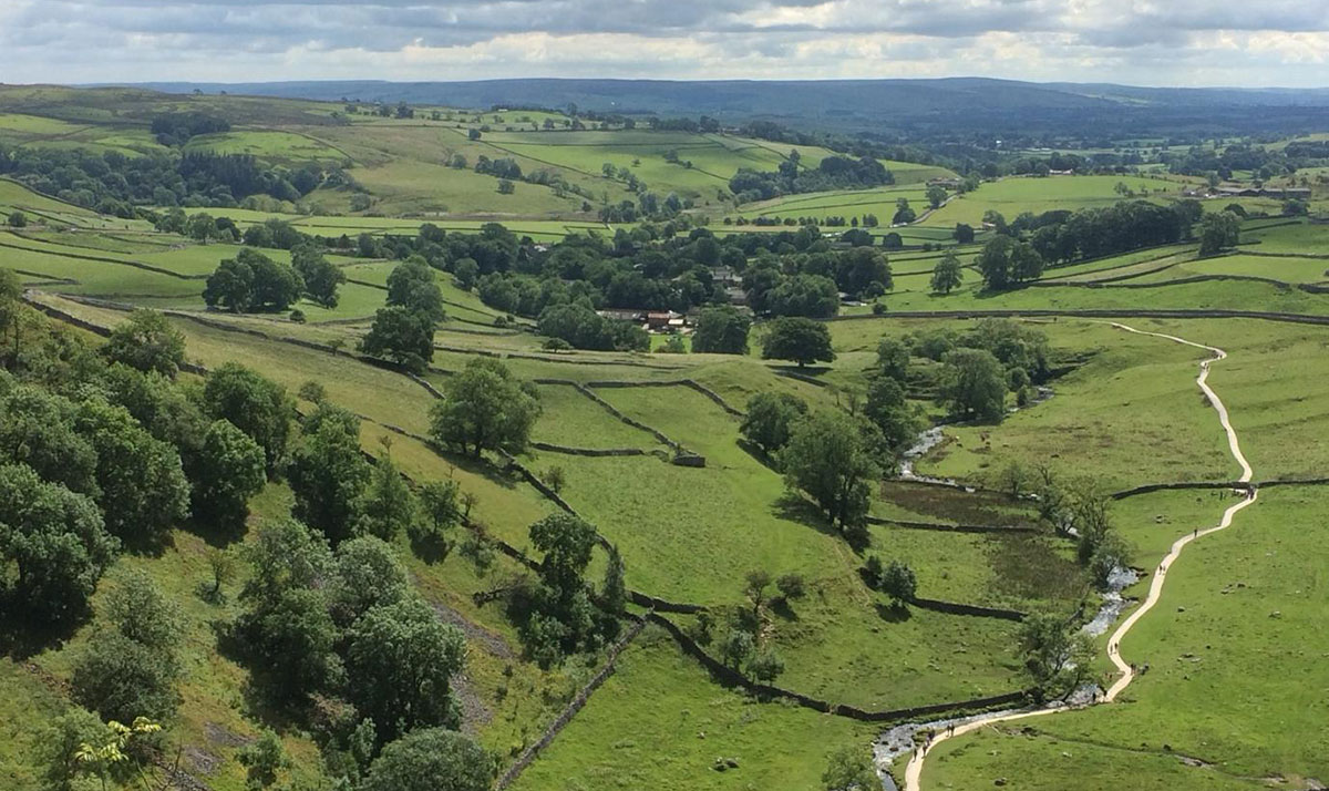
Green Belt is a non-statutory planning designation intended to prevent urban sprawl, safeguard the countryside and maintain the character of towns and cities. Across England there are 15 designated Green Belt areas totalling c. 1.6 million hectares (around 12.5% of England's total land area). They support large, connected networks of farmland, woodland, grassland and wetland habitats. These landscapes often underpin ecological connectivity at a regional scale and may overlap with other environmental designations.
Designated Green Belt Areas
- Birmingham Greenbelt
- Blackpool Greenbelt
- Bournemouth Greenbelt
- Bristol and Bath Greenbelt
- Burton upon Trent Greenbelt
- Cambridge Greenbelt
- Derby and Nottingham Greenbelt
- Gloucester Greenbelt
- Lancaster Greenbelt
- Liverpool, Manchester and West York Greenbelt
- London Area Greenbelt
- North East Greenbelt
- Oxford Greenbelt
- Stoke Greenbelt
- York Greenbelt
Green Belt areas totalling c. 1.6 million hectares (around 12.5% of England's total land area). They support large, connected networks of farmland, woodland, grassland and wetland habitats. These landscapes often underpin ecological connectivity at a regional scale and may overlap with other environmental designations.
Development within the Green Belt can result in habitat loss, fragmentation and displacement of species. Ecological constraints frequently arise where land supports protected or priority species, such as bats, great crested newts, otters, farmland birds, reptiles and species-rich grasslands with notable invertebrate assemblages.
National planning policy states that where it is necessary to release Green Belt land for development, priority should be given first to previously developed land, then to Grey Belt land that is not previously developed, and only then to other Green Belt locations.
The National Planning Policy Framework (NPPF) identifies a limited number of forms of development that are not considered inappropriate in the Green Belt. These exceptions include agricultural and forestry buildings, certain recreational uses, limited infilling in villages, replacement buildings, redevelopment of previously developed land where openness is preserved, and specific infrastructure uses. In addition, Paragraph 84(e) allows for isolated homes in the countryside where the design is of exceptional quality and demonstrably enhances its setting. These schemes are rare and subject to a very high level of scrutiny.
What this means for developers
- Green Belt sites often carry higher ecological risk due to habitat connectivity and protected species presence.
- Ecological constraints identified early can mean that mitigation can be considered at the design stage, reducing costs and increasing the likelihood of planning permission being granted.
- Early ecological feasibility work helps determine whether policy exceptions are realistically achievable before significant design costs are incurred.
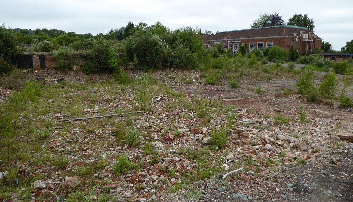
Brownfield: Previously developed land
Brownfield land typically comprises previously developed sites within urban areas that are vacant or underutilised. These sites are often prioritised for housing due to their location and reduced policy constraints when compared with Green Belt land.
However, many brownfield sites support unexpectedly high ecological value. Derelict industrial land, former railway corridors and cleared plots can develop priority habitats such as Open Mosaic Habitat and provide roosting, foraging or nesting opportunities for protected species including bats, birds and invertebrates.
Development on brownfield land can give rise to several ecological impacts. While individual schemes may appear small in isolation, cumulative loss of habitat across urban areas can significantly reduce ecological connectivity. Infill developments on sites smaller than 0.2 hectares are exempt from mandatory Biodiversity Net Gain, increasing the risk that incremental losses go unmitigated.
Additional impacts can include pollution effects on nearby designated sites, such as increased recreational pressure or air quality impacts within defined Zones of Influence, as well as disturbance to species already constrained by urban environments.
Opportunities within brownfield developments
- Delivering biodiversity enhancements alongside housing can support NPPF objectives and reduce objection risk.
- Well-designed green infrastructure can contribute to ecosystem services such as flood management, urban cooling and improved public amenity.
- Exceeding the minimum 10% Biodiversity Net Gain requirement can strengthen planning applications and support positive engagement with local authorities and communities.
What this means for developers
- Brownfield does not equate to low ecological risk and assumptions to that effect often lead to delay.
- Protected species discoveries late in the planning process can trigger redesign or extended survey requirements.
- Early ecological input allows mitigation and enhancement to be designed in from the outset rather than retrofitted at cost.
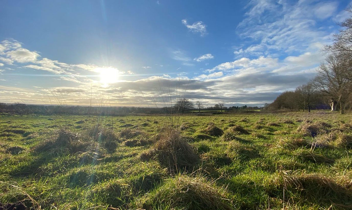
Grey Belt: Potentially developable Green Belt
Grey Belt was introduced into the NPPF in December 2024 and refers to Green Belt land that is previously developed or does not strongly contribute to the core purposes of Green Belt designation. This can include low-quality agricultural land or partially developed sites such as old car parks, quarries or disused industrial land.
In practical terms, local authorities are now required to assess Green Belt land at a more granular level. Individual parcels are evaluated against Green Belt purposes rather than being treated as uniformly constrained. This creates opportunities for areas to be re-designated as Grey Belt, particularly around existing settlements and villages that were previously assumed to be unsuitable.
While Grey Belt land may be more acceptable in planning terms, it can still support valuable habitats and species, particularly where agricultural land has retained hedgerows, field margins or semi-natural features.
Opportunities for development within Grey Belt are more likely where land has been previously developed, is closely related to existing settlements, is not subject to environmental designations and does not contribute to settlement coalescence.
What this means for developers
- Grey Belt represents a genuine opportunity for housing delivery but ecological constraints still apply.
- Early ecological assessment helps distinguish genuinely low-risk parcels from those requiring mitigation or compensation.
- Understanding ecological value early supports realistic land valuations and more robust promotion strategies.
Takeaway
Engaging ecologists early is critical for successful housing delivery across Green Belt, Grey Belt and Brownfield land. Early ecological input helps identify constraints, guide mitigation strategies and integrate biodiversity enhancement from the outset. This approach safeguards wildlife while creating developments that are resilient, policy-compliant and more attractive places to live. Planning with ecology in mind from the start reduces risk, avoids costly redesigns and supports smoother progression through the planning system.


